
Table of Contents
What Makes Weather Phenomena So Captivating?
Think back to the last time you stood in awe of the sky. Maybe it was a blood-red sunset after a volcanic eruption, or the eerie green glow of a tornado-warned storm. Weather phenomena have a way of stopping us in our tracks, reminding us that the atmosphere is a living, breathing system capable of extraordinary displays. While we often take daily weather for granted, rare events like sundogs, lenticular clouds, and ball lightning spark curiosity and wonder.
In this article, we’ll journey through some of the most stunning and bizarre weather phenomena on Earth. You’ll learn the science behind them, where to spot them, and why they matter beyond their beauty.
The Fiery Spectrum: Fire Rainbows and Sun Dogs
What Is a Fire Rainbow?
Despite the name, fire rainbows have nothing to do with fire or rain. Scientifically called circumhorizontal arcs, these colorful bands appear as rainbow-hued clouds drifting across the sky. They form when sunlight passes through high-altitude cirrus clouds made of plate-shaped ice crystals, refracting light at a precise angle. The result? A brilliant streak of red, orange, yellow, green, blue, and violet that looks like a burning rainbow.
Fire rainbows are most common in summer, especially in mid-latitudes, and typically appear when the sun is higher than 58 degrees above the horizon. If you’re in the southern United States or around the Mediterranean, keep your eyes on the sky during hot afternoons.

Sundogs: The Sun’s Mocking Companions
Sundogs, or parhelia, are bright spots that flank the sun on either side, often accompanied by a glowing halo. They occur when sunlight passes through thin, high clouds containing hexagonal ice crystals. The crystals act like prisms, bending the light to create two luminous patches about 22 degrees to the left and right of the sun.
In Nordic folklore, sundogs were thought to be wolves chasing the sun, while in more practical terms, they’re a reliable sign that cold weather is on its way. Next time you see a sundog, take a photo—it’s nature’s way of painting a temporary masterpiece.
Ghostly Lights: Sprites, Elves, and Blue Jets
Transient Luminous Events
High above thunderstorms, in the mesosphere and lower ionosphere, a hidden world of fleeting lights exists. Known as transient luminous events (TLEs), these include red sprites, blue jets, and elves—electrical discharges that last only milliseconds. Sprites appear as giant, reddish-orange jellyfish shapes reaching up to 50 miles high. Blue jets shoot upward from thundercloud tops in narrow cones, and elves are expanding rings of light that ripple across the upper atmosphere.
These phenomena were only confirmed photographically in 1989, though pilots had reported them for decades. Today, astrophotographers and storm chasers capture them from high-altitude aircraft or mountaintops. If you’re fascinated by these ghostly sparks, check out Ghostly UV sparks light up forests as thunderstorms pass overhead for a closer look at how these electrical marvels can also affect the ground below.
St. Elmo’s Fire
Not to be confused with the 1980s movie, St. Elmo’s fire is a continuous, glowing plasma that appears on pointed objects like ship masts, lightning rods, and even airplane wings during thunderstorms. It’s caused by a strong electric field in the atmosphere ionizing the air around the object, creating a blue or violet glow. Ancient sailors regarded it as a good omen, a sign that their ship was protected from lightning. In reality, it signals that the air is highly charged—and a lightning strike could follow.
Ice and Snow: Rare Crystal Creations
Diamond Dust and Light Pillars
When the air temperature drops below freezing and the sky is clear, tiny ice crystals can form near the ground, creating a shimmering effect called diamond dust. These crystals, often invisible to the naked eye, catch sunlight or moonlight and produce vertical beams of light known as light pillars. The pillars appear to rise from streetlights, the sun, or the moon, stretching upward like celestial columns.
Light pillars are most common in polar regions and during cold snaps in temperate zones. For the best view, head to a snowy field at sunrise or sunset with temperatures well below zero.
Snow Rollers
Imagine snowballs rolling across a field, growing larger as they go—without anyone pushing them. These are snow rollers, a rare phenomenon where wind and gravity combine to form cylindrical snow bales. They require a specific set of conditions: a layer of wet, sticky snow on top of a crust of ice or hard-packed snow, plus strong winds to start the rolling. Snow rollers can range from the size of a tennis ball to a large beach ball. They’re fleeting, often collapsing at the slightest touch, so witnessing one is a true stroke of luck.
Water Wonders: Marine and Lake Phenomena
Morning Glory Clouds
In northern Australia’s Gulf of Carpentaria, during spring and early summer, a strange, rolling cloud formation appears at dawn. Known as the Morning Glory cloud, it can stretch for hundreds of miles, often appearing as a single, long tube or a series of parallel rolls. Glider pilots from around the world travel to ride the updrafts along its leading edge. The phenomenon is caused by sea breezes and atmospheric waves interacting with the local geography, creating a solitary wave that traps moisture.
Brinicles: The Icy Finger of Death
Underneath polar sea ice, a bizarre process creates brinicles—hollow tubes of ice that grow downward like stalactites. They form when super-cold brine seeps from the sea ice into the warmer ocean water below. The brine freezes the water around it, creating a dense, sinking column that can reach the seafloor. Anything in its path—starfish, urchins, or small fish—gets trapped and frozen. First filmed for the BBC’s Blue Planet II, brinicles are a stark reminder of the harsh beauty of polar ecosystems.
When the Sky Falls: Volcanic Lightning and Dirty Thunderstorms
Volcanic eruptions can generate their own lightning, a spectacle known as volcanic lightning or a dirty thunderstorm. The eruption cloud contains ash, rock fragments, and ice particles that collide and generate static electricity. The resulting bolts are often more frequent and intense than typical lightning, lighting up the ash plume with a dramatic red-orange glow. The 2010 eruption of Iceland’s Eyjafjallajökull produced some of the most photographed volcanic lightning in history.
If you’re planning a trip to see such phenomena, timing is everything. For instance, Best Places to Visit in November: Sun, Snow, and Serenity offers destinations where you might catch autumn storms or early winter light displays.
Why Understanding These Phenomena Matters
Beyond their Instagram appeal, rare weather events provide valuable data for scientists. For example, studying sprites helps researchers understand the electrical coupling between thunderstorms and the ionosphere. Snow rollers reveal details about snowpack stability, which is crucial for avalanche forecasting. Even ball lightning—a rare, floating orb of light—has been replicated in labs, leading to breakthroughs in plasma physics.
Some phenomena also serve as early warnings. The appearance of sundogs often precedes a warm front, while a green sky before a thunderstorm can indicate large hail. Learning to read these signs can be life-saving.
Where and When to See the Most Spectacular Weather Phenomena
- Northern Lights (Aurora Borealis): Best seen in Iceland, Norway, and Canada from September to March.
- Fire Rainbows: Mid-latitudes in summer, especially Florida, Texas, and the Mediterranean.
- Light Pillars: Cold climates like Alaska, Siberia, or the Alps during winter.
- Morning Glory Clouds: Gulf of Carpentaria, Australia, in September and October.
- Volcanic Lightning: Active volcanoes like Mount Etna (Italy) or Sakurajima (Japan).
- Sprites: Above large thunderstorms in the Great Plains (USA) or the Pampas (Argentina) during spring and summer.
For many travelers, chasing these events becomes a lifelong passion. One such journey is captured in The Feeling We Forgot… Until This Trip Brought It Back, a personal account of rediscovering wonder through nature’s most dramatic moments.
The Intersection of Weather and Technology
Modern tools like satellite imagery, lightning mapping arrays, and high-speed cameras have revolutionized how we study weather phenomena. For instance, the GOES-16 satellite can detect sprites from space, while Doppler radar can identify the unique signatures of hail and tornadoes. Citizen scientists also play a role: apps like iNaturalist and Storm Spotter allow anyone to report unusual sightings, contributing to global databases.
Interestingly, the same principles that govern these atmospheric events also inspire technological innovation. Brain-inspired machines are better at math than expected, showing how nature’s patterns—including those in weather—can inform artificial intelligence. Lightning networks, for example, help predict storm paths, which is crucial for renewable energy grids.
Everyday Phenomena Worth Noticing
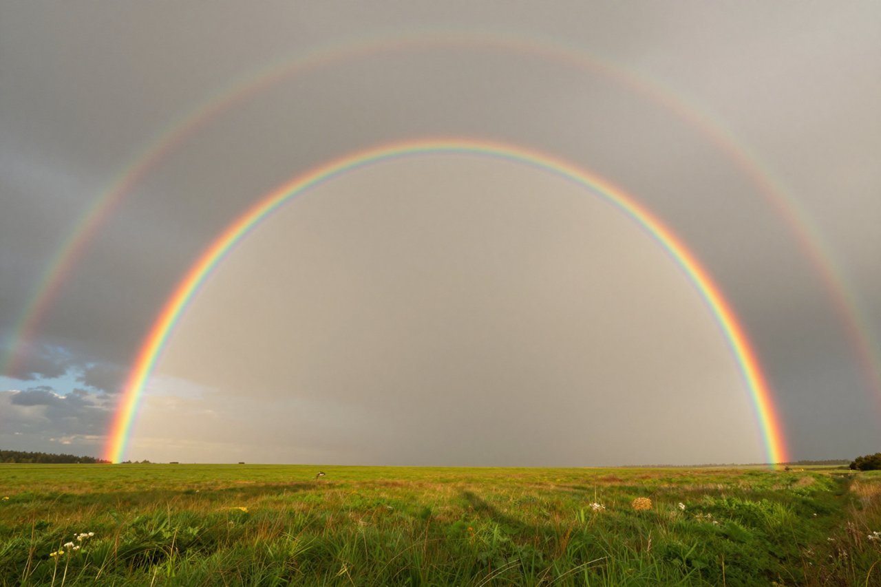
You don’t need to travel to the Arctic or a volcano to see amazing weather. Even common events like rainbows, halos, and crepuscular rays (sunbeams breaking through clouds) are spectacular when you understand the optics behind them. On a foggy morning, look for a fogbow—a faint white rainbow caused by water droplets smaller than raindrops. Or catch a circumzenithal arc, an upside-down rainbow that appears near the zenith.
The next time you step outside, pause and scan the sky. Nature’s grandest shows are often unfolding right above you, free for the taking.


