
Table of Contents
In 1900, a crew of Greek sponge divers sheltering from a storm off the islet of Antikythera surfaced with something that did not belong to their trade: a bronze arm, green with corrosion, pulled from a wreck 50 metres down. They had no idea they had just opened one of the most consequential chapters in the history of archaeology. The cargo they stumbled into held marble statues, glassware, jewellery, coins, and eventually a lump of corroded bronze that turned out to contain at least 30 interlocking gears.
More than a century later, underwater archaeology discoveries still arrive the same way: a fishing net snags something, a dredger hits timber, a survey vessel drags a sonar array across a patch of seabed nobody had bothered to look at. What follows is a look at the finds that genuinely changed what we know, and how the work gets done. For a wider survey of what lies beneath, the sea has been hiding remarkable archaeological finds for millennia, and we are only now getting the tools to read them.
Why the seabed preserves what land destroys
A shipwreck is a closed moment in time. Everything on board was in use during the same season, often the same week. Compare that to a town site, where centuries of rubbish, rebuilding and ploughing get churned together into a layer cake nobody can fully separate.
Water does the rest of the work. Below a certain depth there is no oxygen, no shipworm, no wave action, no tractor dragging a plough through the mud. A hull that would have rotted in a decade on land can sit intact in cold, still, oxygen-poor sediment for two thousand years. That is why submerged sites regularly produce organic material, rope, leather, food residue, human bone, that has simply vanished from comparable terrestrial digs.

Antikythera: a cargo of art and one impossible machine
The wreck off Antikythera dates to roughly 60 BC and appears to have been carrying loot or trade goods westward from the eastern Mediterranean. The statues went to Athens. The corroded lump sat in a museum drawer until 1902, when a curator noticed gear teeth and an inscription.
The Antikythera mechanism is now understood as an astronomical calculator: bronze gears modelling the sun, moon and probably the planets, with a dial for eclipses and a pointer tracking the four-year Olympiad cycle. Nothing of comparable mechanical complexity appears again in the surviving record for over a thousand years. It remains one of those finds that sits awkwardly in the standard timeline, alongside other archaeological discoveries that still resist a tidy explanation.
Excavation resumed in 2014 with closed-circuit rebreathers and a robotic exosuit, and it is still producing material: hull timbers, a bronze spear shaft, ceramics, and in 2016 the skeleton of a crew member, the first human remains from the site in decades.
Thonis-Heracleion: a port city under 10 metres of silt
Ancient Greek texts describe a great Egyptian harbour at the mouth of the Nile, where Helen of Troy supposedly landed and where Heracles was said to have visited. For centuries historians assumed it was either myth or buried under modern farmland. In 2000, Franck Goddio’s team located it in Abu Qir Bay, roughly 6.5 kilometres offshore, under about 10 metres of water and sediment.
What they found was a working city: a temple precinct, colossal statues toppled in place, 700 anchors, bronze coins, and more than 70 shipwrecks. A granodiorite stele inscribed with a decree of Pharaoh Nectanebo I settled the identification, since an almost identical stone had already been found at Canopus on land.
How a city ends up underwater
Thonis-Heracleion was not swallowed by a single catastrophe. The Nile Delta sits on soft, waterlogged sediment, and the weight of monumental stone architecture gradually liquefied and subsided the ground beneath it. Add rising sea levels, earthquakes and a shifting river channel, and the city drowned slowly enough that people kept rebuilding on sinking foundations. It is a pattern repeated wherever cities are built on deltas, and it is why so many lost cities were found by accident rather than by design.
The Black Sea’s deep water graveyard
Between 2015 and 2017, a joint British-Bulgarian team surveyed the Bulgarian shelf using multibeam sonar and found more than 60 wrecks in a single season, spanning Greek, Roman, Byzantine and Ottoman shipping. The deepest ones are extraordinary. Below roughly 150 metres the Black Sea is anoxic, meaning no dissolved oxygen and no wood-boring organisms, so hulls survive with masts, rudders, rigging and coils of rope still in position.
In 2018 the team announced an intact Greek merchant ship at around 2,000 metres, dated to about 400 BC, its mast still upright. It looks like something a model-maker built, not something that has spent 2,400 years on the seabed. The anoxic layer also preserves organic cargo and, potentially, DNA from whatever the amphorae once held, which is where the next round of research is heading.
Drowned landscapes: the world before the water rose
Some of the most important submerged sites are not shipwrecks at all. Around 20,000 years ago, sea levels were roughly 120 metres lower than today, and enormous stretches of coastal plain were dry land where people lived, hunted and buried their dead.
- Doggerland, the plain linking Britain to the Netherlands, has been mapped by trawler finds and seismic survey data, revealing river valleys, saltmarshes and Mesolithic tool scatters.
- Atlit-Yam off the Israeli coast preserves a Neolithic village around 9,000 years old, complete with stone-lined wells, hearths and burials.
- Pavlopetri in southern Greece holds the layout of a Bronze Age town, streets and building plots still legible on the seabed after roughly 5,000 years.
- Bouldnor Cliff off the Isle of Wight has produced worked timber from about 8,000 years ago, evidence of woodworking far earlier than the British land record suggested.
These sites sit at the frontier of a much bigger research question, one that connects to how much we still misunderstand about the ocean floor and the ocean discoveries quietly rewriting the story of our planet. Roughly a quarter of the seabed has been mapped to modern standards. The rest is inference.
How the work actually gets done
Nobody dives blindly hoping for luck. A modern survey runs a sequence:
- Multibeam echosounders build a bathymetric model of the seabed, picking out mounds, scour marks and hull-shaped anomalies.
- Side-scan sonar produces a photographic-style image of surface texture, useful for spotting hard objects in soft sediment.
- Sub-bottom profilers see through the mud to buried structures, which is how deeply silted sites get located without excavation.
- Magnetometers detect iron, from cannon to anchors to modern cables, and are still the fastest way to find historic warships.
- Photogrammetry turns thousands of overlapping photographs into a 3D model, so a site can be studied in detail long after it is reburied.
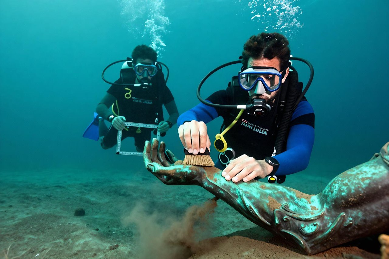
Excavation itself is slow and often deliberately partial. Divers work from a grid frame, use airlifts or induction dredges to shift sediment gently, and record everything in place before lifting it. Then comes the part the public rarely sees: conservation. Timbers and metal objects that have stabilised in seawater can deteriorate fast once exposed to air, so artefacts go into desalination tanks for months or years. The Antikythera mechanism was still being re-imaged and reinterpreted a century after it came up, and it is a good example of how the past keeps rewriting itself as techniques improve.
The legal grey zone, and what is still out there
The 2001 UNESCO Convention on the Protection of the Underwater Cultural Heritage sets out rules against commercial exploitation of wrecks, but enforcement is patchy and several major maritime nations have never ratified it. Deep-water salvage companies with remotely operated vehicles can reach sites that no state can practically police. Trawler nets drag across shallow wrecks every season. Deep-sea mining and offshore construction add pressure on areas that have never been surveyed at all.
Meanwhile the discoveries keep coming. Autonomous vehicles are now cheap enough to sweep large areas of continental shelf, and the 100 to 150 metre depth band, where Ice Age coastlines sit, is the next serious target. Environmental DNA sampling from sealed amphorae could identify trade goods directly rather than by inference. Isotope analysis of hull timbers can pin down where a ship was built. The Antikythera wreck is still only partly excavated, and the Black Sea teams have surveyed a small fraction of one coastline.
There are, by most estimates, three million shipwrecks on the ocean floor. Fewer than a few hundred have been properly studied. The odds that the next storm, dredge or sonar sweep turns up something that resets the timeline again are not small at all.


