
Table of Contents
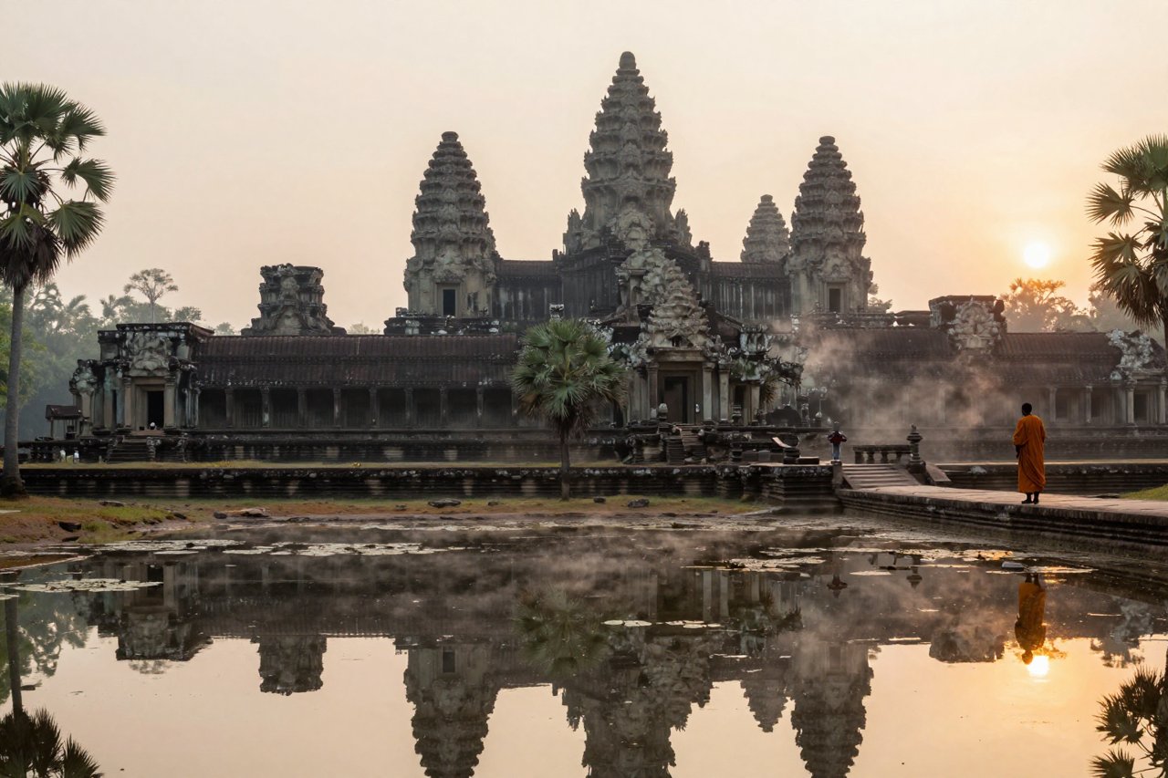
Stand on the stone causeway leading to Angkor Wat just before sunrise and the scale of the place takes a few seconds to register. The moat alone is 190 metres wide. Five towers rise out of the mist, mirrored in still water, and behind them the ground stretches flat and green toward a horizon that once held a city covering roughly 1,000 square kilometres of the Cambodian plain.
That city was the heart of the Khmer Empire, a state that dominated mainland Southeast Asia from 802 to 1431 CE. At its height it controlled territory across modern Cambodia, Thailand, Laos and southern Vietnam, and its capital was the largest pre-industrial urban complex on Earth. Then the forest closed over it, and for centuries European travellers assumed the whole thing was a myth.
A Kingdom Forged on a Sacred Plateau
The Khmer Empire formally begins in 802 CE with a ceremony on Phnom Kulen, a sandstone plateau north of the Tonle Sap lake. A ruler known to history as Jayavarman II had spent years fighting and negotiating his way to dominance. That ceremony declared him chakravartin, universal monarch, and cut the region’s ties with the Javanese powers who had been pulling strings in Southeast Asia for generations.
His other innovation mattered just as much. Jayavarman II established the devaraja cult, the god-king, which fused royal authority with divine mandate. Every Khmer monarch after him inherited that template, and the result was a ruling class with both the motive and the manpower to build on a colossal scale.

For a century the capital drifted between sites. Yasovarman I settled it near modern Siem Reap around 889 CE and named the new city Yasodharapura. It stayed there, more or less, for five hundred years.
The City That Water Built
Most visitors come for temples. The genuine engineering triumph of the Khmer Empire was water.
The barays were the showpieces: vast rectangular reservoirs dug by hand and lined with stone. The West Baray measures 8 kilometres by 2.1 kilometres and held tens of millions of cubic metres. Smaller channels, moats and raised roadways threaded the whole landscape together into a hydraulic grid that modern survey work is still mapping. Water stored in the wet season kept rice fields alive through the dry months, which meant a reliable surplus, which meant you could feed stonemasons, priests and soldiers who produced nothing themselves.
Hydraulic engineering as political theatre
Reservoirs in Angkor were never purely practical. A king who could command the monsoon was a king with a claim on the cosmos. Inscriptions boast about it. Temple moats doubled as symbolic oceans surrounding sacred mountains. When the water system worked, it legitimised the throne as surely as any military victory.
The flip side is that the whole system sat on a knife edge. The Khmer monsoon is erratic by nature, and a state that had grown fat on predictable floods had very little margin when the rains arrived at the wrong time.
Angkor Wat and the God-Kings Who Built It
Construction began around 1113 under Suryavarman II, who dedicated the temple to Vishnu and clearly intended it as his own mausoleum. It took roughly 35 years and an unknown number of labourers. The sandstone blocks arrived by river from quarries more than 30 kilometres away, were dressed on site and fitted without mortar. Nearly 600 metres of bas-reliefs run along the galleries, carved with scenes of battles, heaven and hell, and a famous depiction of the churning of the ocean of milk.
Angkor Wat is the largest religious monument on the planet. What tends to surprise people is that it was never abandoned by the Khmer themselves. Monks have kept it alive continuously, which is a large part of why it survived when so much else did not.
Jayavarman VII: the builder who answered invasion with stone
The empire’s most dramatic chapter came after catastrophe. In 1177 the Chams, a rival kingdom from what is now central Vietnam, sailed up the Tonle Sap and sacked Angkor. It was a humiliation of the first order. Jayavarman VII, probably in his sixties when he took the throne in 1181, drove the Chams out and then spent three decades building as if his life depended on it.
His works are extraordinary in both scale and ambition:
- Angkor Thom, a walled capital covering 9 square kilometres, with five gates and a moat wide enough to swallow a fleet.
- The Bayon, its state temple, crowned with towers stacked with 216 enormous carved faces.
- Ta Prohm, a monastery whose own inscription records that 12,640 people lived and worked in its service.
- Preah Khan, Banteay Kdei and dozens of smaller temples, hospitals and rest houses strung along the roads of the empire.
Ta Prohm is the one that stays with people, because the jungle was allowed to keep it. Silk-cotton roots pour over the galleries like molten bronze, prising blocks apart one monsoon at a time. It is the most atmospheric demonstration anywhere of what the forest does to stone, and it’s featured in this collection of ancient jungle temples reclaimed by the forest.
What Ordinary People Ate, Wore and Prayed For
For a glimpse of daily life, historian luck out in the form of Zhou Daguan, a Chinese diplomat who spent nearly a year at Angkor in 1296 and 1297. His account is gossipy, occasionally appalled, and utterly invaluable.
- Houses were thatched and wooden; only temples and palaces used stone, because stone was for the gods.
- Women ran the markets. Zhou notes that commerce was largely in their hands.
- Rice wine flowed freely, and the elite wore gold and imported Chinese silk.
- Commoners wore simple cloth, and bathing in the rivers was the norm, several times a day.
- Judges swore in temple oaths and bound suspects with ritual force rather than evidence.
Population estimates for greater Angkor range from 750,000 to over a million people spread across that vast sprawl. It was not a dense walled town so much as a low, dispersed, water-fed metropolis — a shape that is hard to see on the ground and that archaeologists missed for decades.
The Slow Unravelling
Decline was not an event. It was a long grind.
In the 13th and 14th centuries a series of Thai kingdoms pushed back against Khmer authority, and Ayutthaya became strong enough to raid the capital directly. Angkor was sacked in 1431. Temple building stopped. Since inscriptions are how we know kings and their wars, and those inscriptions stop too, the record goes dark precisely when we would most like detail.
Buddhism, monsoon failure and a shrinking state
Another force was religious. Theravada Buddhism spread through the Khmer population from around the 13th century, displacing the Hindu and Mahayana Mahayana traditions that had underpinned the god-king model. A form of Buddhism that emphasised individual merit and monastic detachment left little room for a monarch to justify enslaving a province to build a reservoir. When the ideology that drives monumental construction weakens, the construction quietly stops.
Add in a run of poor monsoons, the breakdown of the hydraulic network, and a shift in maritime trade that made coastal capitals like Phnom Penh and Lovek more attractive than a landlocked stone city, and the picture is less collapse than slow evaporation. The Khmer state survived. Its capital simply moved. Civilisations disappear like this more often than they go out with a bang, as this survey of lost civilisations and their legacies makes clear.
Rediscovery, LiDAR and the Myth of the Lost City
The French explorer Henri Mouhot published his account of Angkor in 1860 and became the figure usually credited with ‘discovering’ it. This is nonsense, politely speaking. Khmer farmers had lived beside the temples for four hundred years, and Portuguese friars were writing about them in the 16th century.
The real revelation came from the air. Between 2012 and 2015 a LiDAR survey fired lasers through the canopy and stripped away the vegetation, revealing a landscape nobody had mapped: rectilinear street grids, earthen mounds where houses stood, roads connecting temples through the forest, and a sprawl far beyond the moats. Angkor’s urban footprint was larger than historians had assumed, in some areas by an order of magnitude. It deserves a place among the great lost cities that vanished from the historical record, even though its people never really left.
What the Ruins Ask of Visitors Now
Angkor Archaeological Park pulled in millions of visitors a year before 2020, and the pressure shows. Sandstone stairs are worn into curves. Some bas-reliefs are roped off. The Cambodian government, with UNESCO and the APSARA Authority, restricts entry at the most delicate spots and has spent decades on restoration projects that require teams to dismantle and rebuild sections block by block.
If you go, the practical detail matters more than most guidebooks admit. Start at sunrise, not because it’s a cliché, but because the west causeway of Angkor Wat faces the rising sun and the crowd is thinner before seven. Do the big temples in the morning and Ta Prohm in the late afternoon, when the light comes in sideways through the trees and most tour groups have gone. Hire a Khmer guide for at least one day, since the carvings mean almost nothing without the stories behind them. And drink more water than you think you need.
What makes the Khmer Empire memorable is not the temples on their own. It’s the realisation that a kingdom without iron ore in abundance, without horses on a massive scale, and without the wheel used for transport, managed to mobilise the labour to shift six million tonnes of sandstone and dig reservoirs you can still see from space. That kind of ambition leaves a mark on a landscape for centuries, long after the kings who ordered it are names on a stone you can’t quite read.


